| Places | |
|---|---|
| Accession Number | RCDIG0000813 |
| Collection number | 3DRL/2379 |
| Collection type | Digitised Collection |
| Record type | File |
| Item count | 8 |
| Object type | Map |
| Physical description | 12 Image/s captured |
| Maker |
Goddard, Henry Arthur |
| Place made | France |
| Date made | 1917-1918 |
| Conflict |
First World War, 1914-1918 |
| Copying Provisions | Digital format and content protected by copyright. |
Maps collected and used by Henry Arthur Goddard


Description
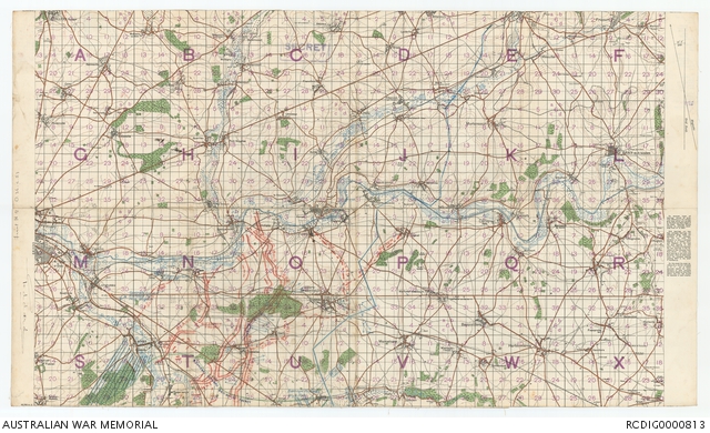
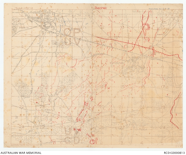
File of maps relating to the First World War service of Brigadier General Henry Arthur Goddard, 9th Brigade, Australian Imperial Force. The maps show various defensive and offensive lines held by the allies and the locations of trenches used by the 9th Brigade at Villers-Bretonneux between 1917 and 1918.
This file contains:
Map of the Allied Line, with British Line on reverse, scale 1:100000, 31 July 1917;
Map of France showing the Hindenburg Line and German Artillery positions, scale 1:20000, 3 February 1918;
Pencil drawn map with approximate line before and after attack at 6pm, 13th April 1918;
Map of Villers-Bretonneux, scale 1:40000, 13 April 1918;
Map of trenches near Villers-Bretonneux, scale 1:20000, 12 April 1918;
Map of Villers-Bretonneux during March 1918, scale 1:40000, 4 to 5 May 1918;
Map of Vilers-Bretonneux, scale 1:40000, sheet 62D, 6 May 1918;
35 Battalion Map showing divisions from Gavrelle to the Somme, [n.d.];