| Accession Number | RC11577.1731 |
|---|---|
| Map call number | G8140 s25 H957 |
| Collection type | Published Collection |
| Record type | Item |
| Item count | 1 |
| Object type | Map |
| Maker |
6 Australian Army Topographical Survey Company (AIF) |
| Date made | October 1943 |
| Conflict |
Second World War, 1939-1945 |
| Copying Provisions | Digital format and content protected by copyright. Non-commercial use permitted. |
Fortification Point : New Guinea 1:25 000
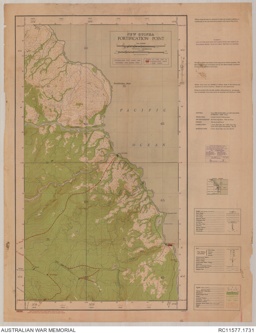
Description
The Fortification Point (Huon Peninsula) sheet from the New Guinea 1:25 000 topographical map series overprinted to show revised place names, tracks and suspension bridge. Shows also coastal reefs, cliffs, populated places, isolated buildings, mission station, the Masaweng, Sanga and other rivers, vegetation and terrain features. Relief shown by contours. "FIR/505/2059". Includes legend and locality diagram. Compilation by 1 Aust. Mob. Litho. Sec. (AIF), Aust. Survey Corps ... Oct. 43 ; reproduction by 6 Aust. Army Topo. Svy Coy, Oct. 43 ; red overprint by 6 Aust Army Topo. Svy Coy, AIF, from information supplied by HQ New Guinea Force.