| Accession Number | RC11577.1911 |
|---|---|
| Map call number | G8182.A2 s25 |
| Collection type | Published Collection |
| Record type | Item |
| Item count | 1 |
| Object type | Map |
| Maker |
Royal Australian Survey Corps |
| Date made | 1952 |
| Conflict |
Second World War, 1939-1945 |
| Copying Provisions | Digital format and content protected by copyright. Non-commercial use permitted. |
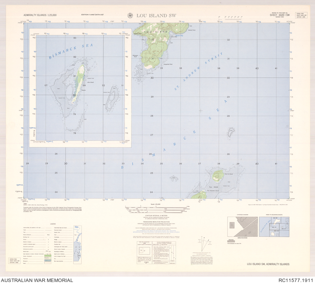
Lou Island SW : Admiralty Islands 1:25,000, sheet 3649 I SW
Description
Map of the southern part of Lou Island and surrounding area, southeast of Manus Island, in the Admiralty Group, Papua New Guinea. Shows the Bismarck Sea, St Andrew Strait, islands, bays and prominent points, coral and submerged reefs, populated places, huts on stilts, tracks, watercourses, plantation and other vegetation and terrain features. Relief shown by contours and spot heights. "Reprint of AMS T893 Edition 1 by Royal Australian Survey Corps AHQ/B4-8/1106". Includes legend, coverage diagram, index to adjoining sheets, and inset map of Alim Island. Standard map series designation: T893. prepared under the direction of the Chief of Engineers by the 30th Engineer Group (Topographic Survey). Series T893. AMS series T893. Admiralty Islands 1:25,000.