| Accession Number | RC11577.1724 |
|---|---|
| Map call number | G8140 s25 H957 |
| Collection type | Published Collection |
| Record type | Item |
| Item count | 1 |
| Object type | Map |
| Maker |
2/1 Australian Army Topographical Survey Company |
| Date made | 24 August 1943 |
| Conflict |
Second World War, 1939-1945 |
| Copying Provisions | Digital format and content protected by copyright. Non-commercial use permitted. |
Hopoi : New Guinea 1:25 000
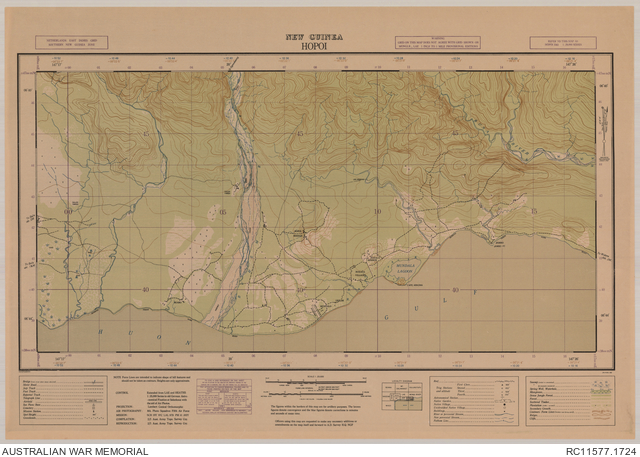
Description
A single sheet from the New Guinea 1:25 000 topographical map series covering the area around the village of Hopoi, on Huon Peninsula east of Lae, Morobe province, Papua New Guinea. Shows populated places, isolated buildings, missions, overgrown Hopoi airfield, tracks, the Buhem, Busa and other rivers, native gardens, sago swamp areas and other vegetation and terrain features. Relief shown by contours. "NGF/703/3561 ... 24 Aug. 43". Includes legend and locality diagram. Compilation [and] reproduction, 2/1 Aust. Army Topo. Survey Coy.