| Accession Number | RC11577.1763 |
|---|---|
| Map call number | G8140 s25 H957 |
| Collection type | Published Collection |
| Record type | Item |
| Item count | 1 |
| Object type | Map |
| Maker |
2nd Field Survey Company 6 Australian Army Topographical Survey Company (AIF) |
| Date made | June 1944 |
| Conflict |
Second World War, 1939-1945 |
| Copying Provisions | Digital format and content protected by copyright. Non-commercial use permitted. |
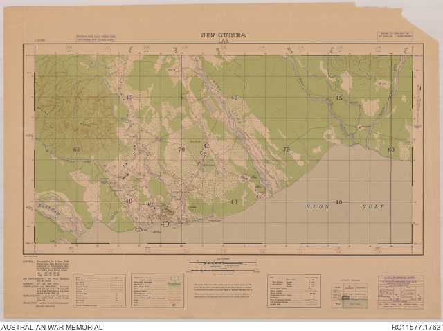
Lae, New Guinea 1:25 000 [Copy 2]
Description
A single sheet from the New Guinea 1:25 000 topographical map series covering the area around the town of Lae, capital of Morobe province, Papua New Guinea. Shows town plan and main buildings, wharfs and wrecks, airstrip, telegraph and electric transmission lines, pipe lines, cemeteries, roads and tracks, the Markham, Busu and other rivers, Malahang plantation and other vegetation and terrain features. Relief shown by contours. "ADV/703/0445". Includes legend and locality diagram. Compilation and drawing by 2 Aust. Field Survey Coy., Aust. Survey Corps, Mar. '44 ; reproduction, 6 Aust. Army Topo. Survey Coy. (AIF), Aust. Survey Corps, June '44. Refer to this map as: No. 0445 Lae 1:25,000 series.