| Accession Number | RC11577.1829 |
|---|---|
| Map call number | G8140 s25 W544 |
| Collection type | Published Collection |
| Record type | Item |
| Item count | 1 |
| Object type | Map |
| Maker |
6 Australian Army Topographical Survey Company (AIF) L.H.Q. Cartographic Coy., Aust. Survey Corps. |
| Date made | April 1945 |
| Conflict |
Second World War, 1939-1945 |
| Copying Provisions | Digital format and content protected by copyright. Non-commercial use permitted. |
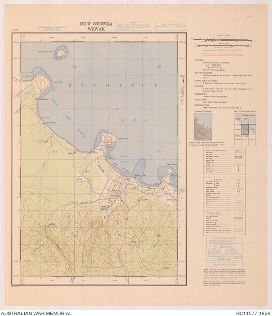
Wewak : New Guinea 1:25 000
Description
A single sheet from the New Guinea 1:25 000 topographical map series covering the area around the coastal town of Wewak, East Sepik province, Papua New Guinea. Shows islands and reefs in the Bismarck Sea, basic town plan and main buildings, jetties, Wewak and Wirui Missions, Wewak Drome, Boram Drome, other populated places, isolated buildings, roads, tracks, destroyed bridges, watercourses, sago swamps, native gardens and other vegetation and terrain features. Relief shown by contours. "LH Q/295/3183". Includes legend and index to adjoining sheets. compilation & detail, 6 Aust. Army Topo. Svy Coy., Apr. 45 ; drawing, 6 Aust. Army Topo. Svy Coy. and LHQ Cartographic Coy., Aust. Svy. Corps, Apr. 45 ; reproduction, LHQ Cartographic Coy., Aust. Svy. Corps, Apr. 45.