| Accession Number | RC11577.1897 |
|---|---|
| Map call number | G8182.A2 s25 |
| Collection type | Published Collection |
| Record type | Item |
| Item count | 1 |
| Object type | Map |
| Maker |
Royal Australian Survey Corps |
| Date made | 1952 |
| Conflict |
Second World War, 1939-1945 |
| Copying Provisions | Digital format and content protected by copyright. Non-commercial use permitted. |
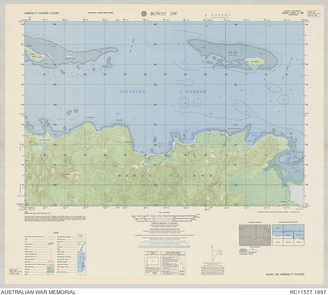
Bowat SW : Admiralty Islands 1:25,000, sheet 3651 III SW
Description
Map of the area around the village of Derimbat, west of Bowat, on the north coast of Manus Island, Admiralty Group, Papua New Guinea. Shows the Bismarck Sea, part of Manus and other islands in Seeadler Harbor, coastal and submerged reefs, approaches to the harbour and small boat passages, populated places, tracks, rivers and creeks, plantations and other vegetation features. Relief shown by contours, spot heights and bathymetric soundings. "Printed by Royal Australian Survey Corps AHQ/B4-8/1123". Includes legend, coverage diagram and index to adjoining sheets. Standard map series designation: T893. prepared under the direction of the Chief of Engineers by the 30th Engineer Group (Topographic Survey). Series T893. AMS series T893. Admiralty Islands 1:25,000.