| Accession Number | AWM2022.10.4 |
|---|---|
| Collection number | RC11577.1765 |
| Map call number | G8140 s25 H957 |
| Collection type | Digitised Collection |
| Record type | Item |
| Item count | 1 |
| Object type | Map |
| Physical description | 2 Image/s captured |
| Maker |
2/1 Australian Army Topographical Survey Company |
| Date made | July 1943 |
| Conflict |
Second World War, 1939-1945 |
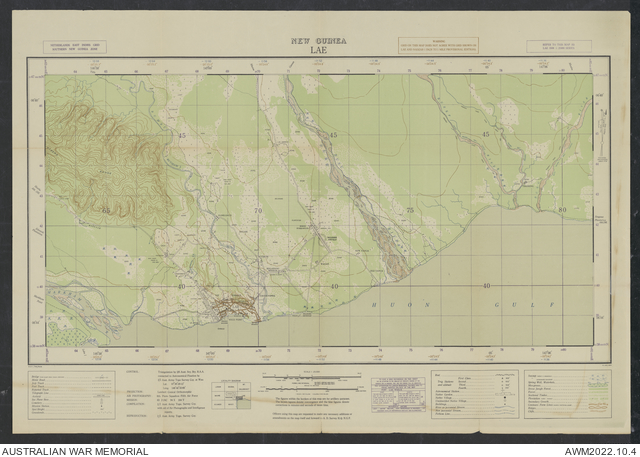
Lae, New Guinea 1:25 000

Description
A single sheet from the New Guinea 1:25 000 topographical map series covering the area around the town of Lae, capital of Morobe province, Papua New Guinea. Shows basic town plan and main buildings, wharfs and wrecks, mission, Lae and Malahang airfields, roads and tracks, the Markham, Busu and other rivers, Malahang plantation and other vegetation and terrain features. Relief shown by contours. "NGF/703/3508 ... 15 Jul. 1943". Includes legend and locality diagram. Compilation [and] reproduction by 2/1 Aust. Army Topo. Survey Coy