| Place | Asia: Netherlands East Indies, Sumatra |
|---|---|
| Accession Number | AWM2022.10.64 |
| Collection number | G8070.S73 svar |
| Collection type | Digitised Collection |
| Record type | Item |
| Item count | 1 |
| Object type | Map |
| Physical description | 2 Image/s captured |
| Maker |
US Army Map Service |
| Place made | United States of America: Washington DC |
| Date made | [195?] |
| Conflict |
Indonesian Confrontation, 1962-1966 |
| Source credit to | This item has been digitised with funding provided by Commonwealth Government. |
[Map of Sibolga and surrounding area, north Sumatra]
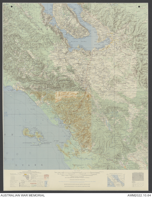
Description
Several joined sheets adhered to linen to form a topographical map covering the area around the city of Sibolga, north Sumatra. Scale 1:250,000. Shows the Indian Ocean coastline, outlying islands and reefs, populated places, main roads with distances marked, cemeteries, churches and mosques, Lake Toba, rivers and streams, cultivated and wetland areas, terrain features. Relief shown by contours, shading, spot heights, and bathymetric isolines. Includes legend, location diagram, and reliability diagram.
Related information
Related Objects
- Map Overlay, Sibolga, Indonesia; Beaches, Ports, and Navigable Waterways
- Map Overlay, Sibolga, Indonesia; Location of Photographs
- Map Overlay, Sibolga, Indonesia; Landing Sites and Personnel Drop Zones
- Map Overlay, Sibolga, Indonesia; Settlement and Population
- Map Overlay, Sibolga, Indonesia; Land Transportation, Communications and Power Lines
- Map Overlay, Sibolga, Indonesia; Climate
- Map Overlay, Sibolga, Indonesia; Vegetation
- Map Overlay, Sibolga, Indonesia; Terrain and Slope