| Place | Africa: South Africa, Cape Colony, Kimberley Area |
|---|---|
| Accession Number | AWM2022.10.720 |
| Map call number | G8511.s55 s844 |
| Collection type | Digitised Collection |
| Record type | Item |
| Item count | 1 |
| Object type | Map |
| Physical description | 1 Image/s captured |
| Maker |
W. A. Gullick, Government Printers |
| Place made | Australia: New South Wales, Sydney |
| Date made | [1902] |
| Conflict |
South Africa, 1899-1902 (Boer War) |
| Source credit to | This item has been digitised with funding provided by Commonwealth Government. |
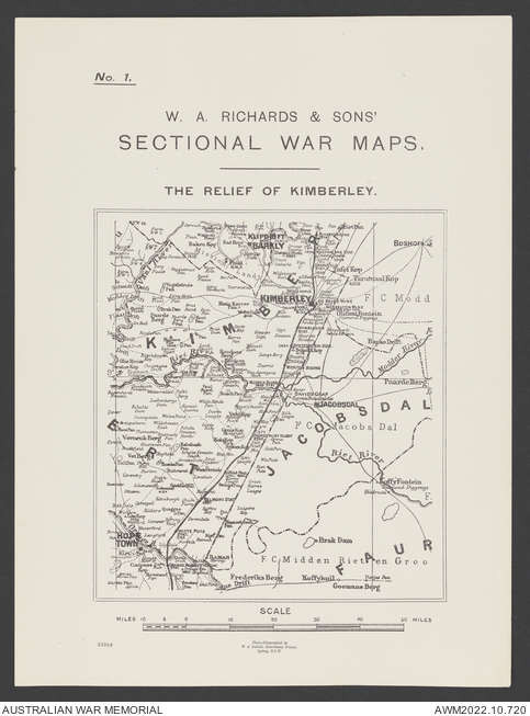
W.A. Richards and Sons' Sectional War Maps; The Relief of Kimberley
Description
A topographic map titled 'W.A. Richards and Sons' Sectional War Maps; The Relief of Kimberley' covering the area around Kimberley, South Africa. Scale ca. 1:844,800, no 1, W.A. Gullick, Government Printer, Sydney, NSW. Shows roads, railways, boundaries, populated places, pans, and rivers.