| Accession Number | AWM2023.10.20 |
|---|---|
| Map call number | G5830 s10 |
| Collection type | Digitised Collection |
| Record type | Item |
| Item count | 1 |
| Object type | Map |
| Physical description | 2 Image/s captured |
| Date made | 1917 |
| Conflict |
First World War, 1914-1918 |
| Copying Provisions | Digital format protected by Copyright. Copyright of content expired. |
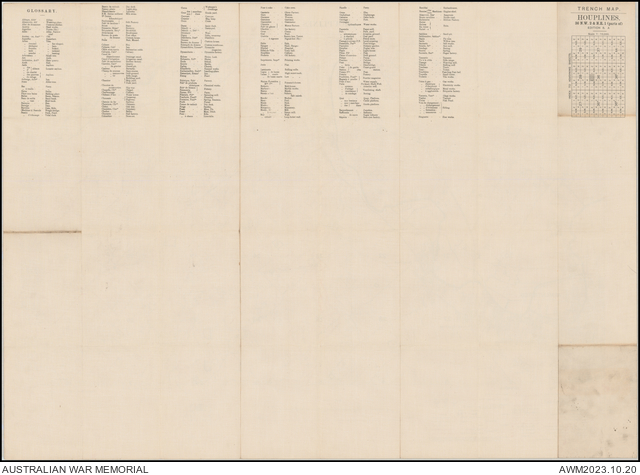
Houplines trench map : 36 N.W. 2 & N.E. 1 (parts of) [cartographic material] : trenches corrected to 7.5.17 / Ordnance Survey, May 1917.

Description
A single sheet from the Belgium/France 1:10 000 trench map series (GSGS 3062) covering the area around the French towns of Houplines and Frelinghien. Panel title. Shows British front line trenches and enemy trenches, wire, railways, communication cables, huts, dumps, and bridges over the Lys River, as at 7 May 1917. Main enemy trenches marked with English names. Includes legend, index to adjoining sheets and glossary.