| Places | |
|---|---|
| Accession Number | AWM2016.38.81 |
| Map call number | G5831.S65 Sheet 6.13.1 |
| Collection type | Digitised Collection |
| Record type | Item |
| Item count | 1 |
| Object type | Map |
| Physical description | 1 Image/s captured |
| Date made | 1916 |
| Conflict |
First World War, 1914-1918 |
Aubers
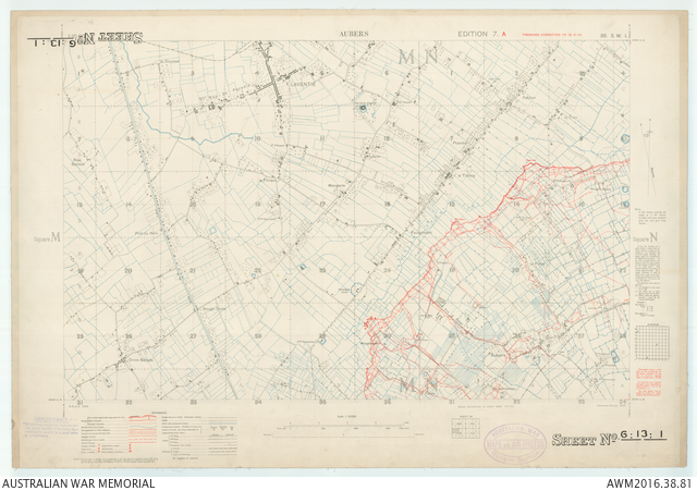
Description
Sheet 36SW1 of the 1:10 000 map series covering the area around Aubers and Laventie in northern France. Relief shown by form lines. Shows populated places, transport, vegetation and water features, the British front line and enemy trenches, obstacles, and mine craters. "Trenches corrected to 14-6-16". Includes legend and index to adjoining sheets. "G.S.G.S. No. 3062 ... Ordnance Survey 1916".