| Place | Asia: Borneo |
|---|---|
| Accession Number | AWM2016.38.220 |
| Collection number | G8033.S35 s253 A938 |
| Collection type | Digitised Collection |
| Record type | Item |
| Item count | 1 |
| Object type | Map |
| Physical description | 1 Image/s captured |
| Maker |
AUSTRALIA : ROYAL AUSTRALIAN SURVEY CORPS., 1985 |
| Date made | 1944 |
| Conflict |
Second World War, 1939-1945 |
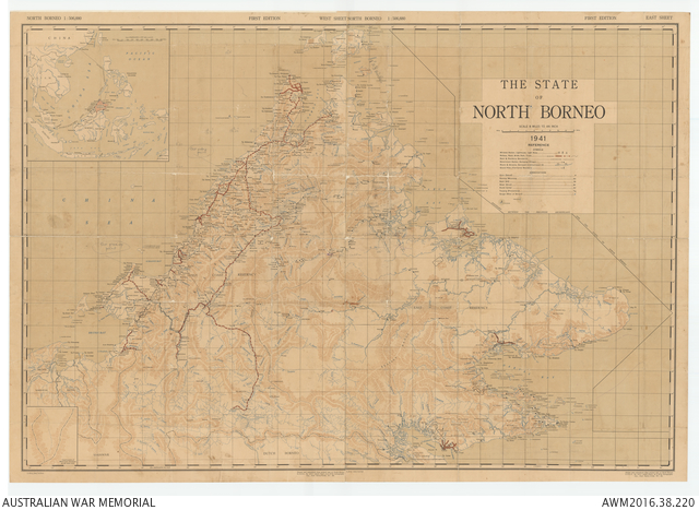
The State of North Borneo 1941
Description
Complete Sarawak topographical map series in 11 adjoining sheets, with relief shown by hachures and spot heights. Scale 1:253 440. Shows villages and longhouses, mission stations, district headquarters, roads, tracks, railways, aerodromes, rivers and navigational limits, terrain and vegetation features. Includes legend, glossary, and index to adjoining sheets. "LHQ/279/1526-1536". The map is annotated showing where the party of Operation Agas III under F/Lt Ripley RAAF were inserted at Jembongan on 21 June 1945 and also where they were later picked up.