| Accession Number | J00067 |
|---|---|
| Collection type | Photograph |
| Object type | Black & white - Glass original half-plate negative |
| Maker |
Unknown |
| Place made | France: Picardie, Somme, Albert |
| Date made | April 1918 |
| Conflict |
First World War, 1914-1918 |
| Copyright |
Item copyright: Copyright expired - public domain
|
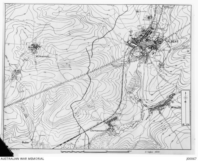
Contour map from Amiens to Pozieres. Somme position, Section 1, Albert. (Showing Lavieville ...


Description
Contour map from Amiens to Pozieres. Somme position, Section 1, Albert. (Showing Lavieville Crest, overlooking Albert - Dernacourt). Prior to the battle the Australians held an outpost line along the railway. Black line shows position of their line up the hill after the battle. Map AW. No. 10, drawn by 6449 Corporal Edgar Francis Halford, Australian War Records Section.