| Place | Europe: Belgium, Flanders, West-Vlaanderen, Ypres, Zonnebeke |
|---|---|
| Accession Number | AWM2016.30.85 |
| Collection number | PR00597 |
| Collection type | Digitised Collection |
| Record type | File |
| Item count | 1 |
| Object type | Map |
| Physical description | 2 Image/s captured |
| Maker |
Great Britain War Office |
| Place made | United Kingdom: England, Greater London, London |
| Date made | 1917 |
| Conflict |
First World War, 1914-1918 |
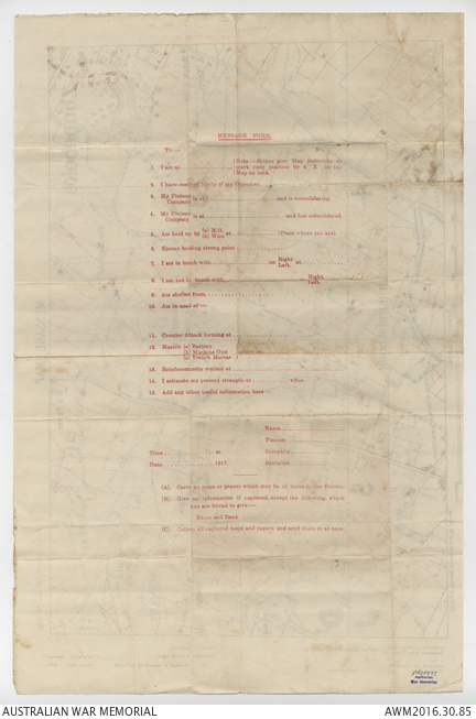
Message Map: Zonnebeke
Peach, William Edward MM (Sergeant, b.1896 - d.1966)
- Series 3: Maps relating to the Third Battle of Ypres, 1917
< Previous Record
Description
Message map relating to the First World War service of 4272 Sergeant William Edward Peach, 7th Battalion. This trench map, presumably used by Peach himself, depicts the area of front line held by I Anzac Corps in the Zonnebeke sector prior to the Battle of Broodseinde Ridge but after the gains made at the Battle of Polygon Wood. The map depicts the area south-east of Zonnebeke, including such features as Romulus Wood and Molenaarelsthoek. German trenches, strong points and dugouts, corrected as of 28 September 1917, are depicted in red.