METIS and Monash – An Inside Look into the Memorial’s Map Digitisation Project
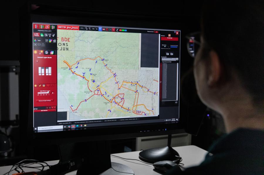
The Digitised Collection team use a variety of scanning devices including the METIS.
The Memorial is currently digitising over 300 First World War maps that form part of the Sir John Monash Collection (3DRL/2316). This is just one component of an ongoing digitisation project involving over 1900 maps spanning multiple conflicts – a project that has taken significant time, resourcing and planning to achieve.
One might think digitisation is a simple process – place an object on the scanner and hit ‘go’ – but in practice many considerations need to be taken into account before and throughout the digitisation process. What kind of object it is? Is it bound or three-dimensional? Is it colourful or gilded or embossed? What size is it? How much detail do we need to capture? Does it need to be reproduced for print or for digital applications? How will we transport and handle the object, and how fragile is it?
To ensure the Memorial’s Research Centre is prepared for the vast array of objects held in its archive, our Digitised Collection team works across half a dozen different scanning devices (not to mention the photographic studio and specialty equipment utilised by the Photos, Film and Sound section). But when the Research Centre devised this map digitisation project in 2018, we did not yet have the capability to scan the maps to the desired standard.
Enter the METIS.
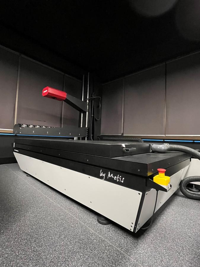
'Mario' the METIS
Colloquially known to the digitisation team as ‘Mario’, after its manufacturing origin in Italy, the METIS scanner is capable of capturing high resolution images to internationally recognised standards for cultural heritage digital preservation. It scans images up to 2 metres wide in a single ‘capture’ and has excellent colour, texture and surface finish representation, making it the perfect device for these maps.
Though the COVID-19 pandemic put an early pause on our map project, once we were back in the office – and with the help of a crane and the removal of some window panels – the METIS was eventually installed in 2022. It is now one of the most versatile and frequently used scanners in our arsenal.
From here map digitisation could begin.

Map getting digitised using METIS
This process involves:
- Liaising with the Private Records and Official Records curatorial teams
- Packaging and transporting the item from the Memorial’s collection storage facilities to our offsite digitisation facility (soon to be back in a new building on the Memorial’s main site)
- Cleaning and calibration of the scanner
- Careful movement of the item onto the scan-bed and removal of any protective housing
- Scanning of the object and adjustment of settings as necessary
- Quality assurance of the images by another team member
- Upload of the digital object into our digital asset management system for ongoing storage
- Packaging and return of the item to its original storage
- Cataloguing of the item in our collection management system
- Publishing of the digital object to the Memorial website (once copyright has been cleared)

The Digital Collection team captured over 500,000 images last year
For particularly fragile materials, or those that are difficult to digitise, additional steps are often required. This can involve using a vacuum board or a clear plexiglass overlay to assist with flattening the object. In some cases the object may require conservation treatment, in which case it is sent to the Memorial’s Paper Lab before it is digitised.

A colour map of Paris. AWM2022.10.587
The above map is one of the 315 maps from the Sir John Monash Collection (3DRL/2316) that were selected for digitisation as part of this project. The maps detail various locations and situations relating to the First World War, including military positions, trench locations, barrage lines, and topographical information. Many of these maps have very fine detail and feature vibrant colours, hand-drawn illustrations and diagrams, and handwritten annotations. Inscriptions can also be found on the back of some of the maps. All of this detail has been carefully captured by the METIS with the skilled hands of our digitisation team.
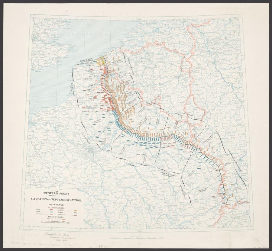
Map of the Western Front - September 25th 1918. AWM2022.10.602
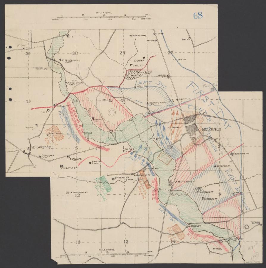
Hand-drawn map showing movements of troops between Wulverghem and Messines. AWM2022.10.414
These century-old maps are not only visually captivating – they are also an invaluable resource in strengthening our understanding of the First World War, and are now preserved in both physical and digital form. They will continue to be made accessible into the future for staff, researchers, and members of the public alike.
The maps included above will soon be added to the Memorial’s website. You can view the Digitised Collection on the Memorial's website.