Rendering a small service to Italy in 1917
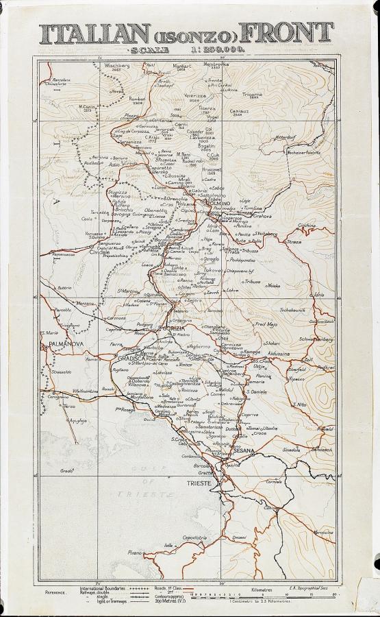
Several years ago, when I worked in the Memorial’s Research Centre, one collection item I researched was a wonderful and very rare Australian Imperial Force (AIF) map of the Italian front, held in the Memorial’s collection. This item is very unusual in the Memorial’s collection, if for no other reason that the AIF was not involved in the fighting on this front. However, in October 1917, some Australians map makers rendered Italy a small service in their fight against the Austro-Hungarian and German armies.
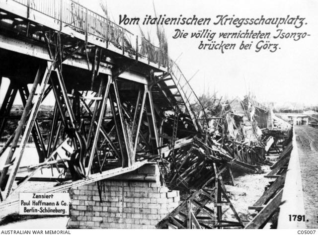
The damaged Isonzo bridge at Gorizia, Italy.
During August and September 1917 the ANZAC Corps Topographical Section rested behind the lines at Hazebrouck in Belgium. As no other work was required, they decided to keep up their mapping skills creating a five colour map lithographic map of the Italian front around the Isonzo River. They were over half way completed when they moved back into the line to take part in the Third Battle of Ypres.
On 24 October 1917 the Austro-Hungarian and German forces broke through the Italian defences on the Isonzo Front. Called the Battle of Caporetto (or the Twelfth Battle of the Isonzo), the Italians were caught by surprise and they lost ground. Although they attempted to regroup and hold the new line, they failed. Between 24 October and 10 November, the Italians retreated approximately 100 kilometres.
After the initial attack, the Italians requested assistance from the British and French. Based on early reports, the British thought the Italians could hold for five weeks before reinforcements were needed. These reports made the fighting sound sporadic and of no great threat to the Italian front line. However, on 26 October the Austro-Hungarians and Germans completed their breakthrough and the British realised the situation was far more serious than first thought.
After hearing about the breakthrough, the Topographical Section finished their map overnight. It was the most up to date map available of the Isonzo front and copies were sent to units and to the Intelligence section of the Second Army. General Herbert Plumer, Commander of the Second Army, used a copy of this map at a conference of army commanders on 27 October as they discussed the situation.
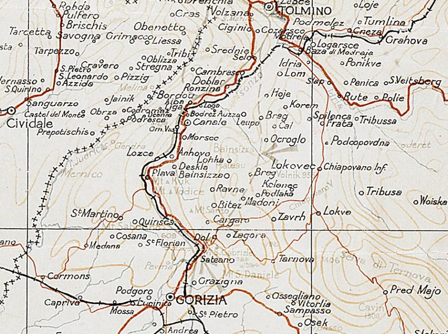
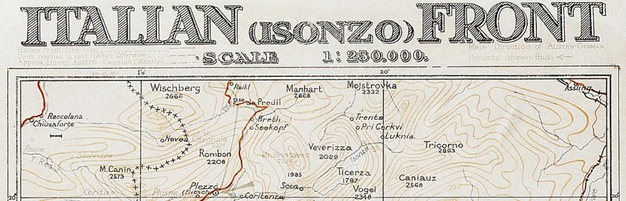
The map is dated 27 October 1917 and it has been 97 years ago today since it was first published but its condition belies its age. It shows the extent of the Italian advances before 24 October, and the areas subsequently captured by the Austro-Hungarian and German armies by 25 October. is possibly the only contemporary map in existence showing the front line as it was at the end of the first day’s fighting. When the British history of the Italian campaigns was written in 1949, the author stated there were no maps showing the Isonzo front between 24 and 27 October – he was presumably not familiar with this map, of which only 200 copies were printed.
Amusingly, the Topographical Section’s war diary for November relates that the British General Staff were mystified as to how such a small section could produce a detailed situation map at such short notice. They were never told most of it had been completed weeks before!